- info@apegenagency.com
- Navi Mumbai, Maharashtra, IN
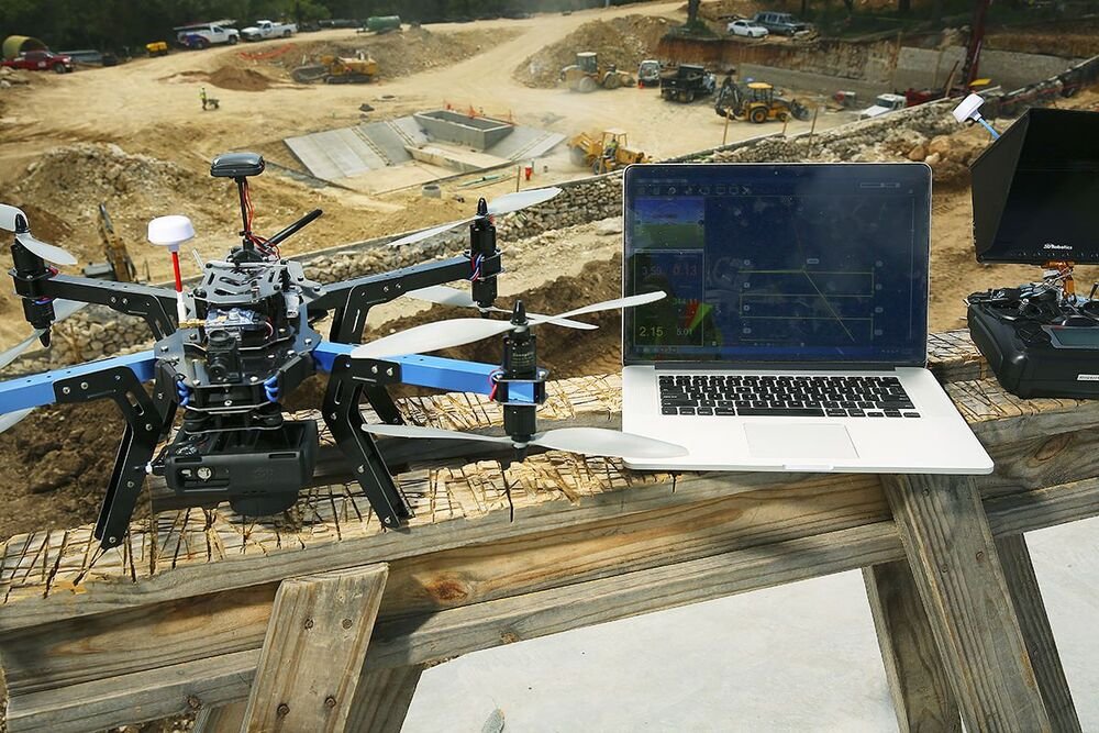
Drone Mapping
🛰️ Drone Mapping
Drone Mapping Services For Accurate Aerial Surveys, 3D Modeling & Geospatial Intelligence
We provide professional drone mapping services by capturing high-resolution aerial imagery to create detailed maps, 3D models, orthomosaics, and geospatial data deliverables. Our end-to-end solutions combine precise data acquisition, advanced data processing, and professionally structured deliverables to deliver highly accurate measurements and visual representations for land surveying, construction, infrastructure planning, agriculture, mining, and development projects.


what can we offer
Services we're offering
1

Data Acquisition
Capturing high-resolution aerial data using advanced drone technology, including images, videos, and geospatial inputs of land, buildings, and surrounding environments with exceptional precision and accuracy.
2

Data Processing
Converting captured drone data into highly accurate maps, 3D models, orthomosaic images, and geospatial outputs using advanced processing software for detailed analysis, planning, and project development.
3

Deliverables
Providing professionally structured deliverables including detailed maps, 3D models, survey data, and actionable reports to support planning, monitoring, development, and informed decision-making across diverse projects.
Serving Industries


Can You find Now